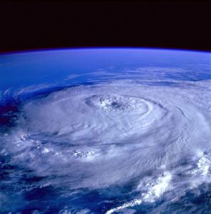
 Gonzalo has become a major hurricane over the Atlantic and is a threat to Bermuda.
The Bermuda Weather Service’s 6pm update showed the closest point of approach to the Island within 72 hours was forecast to be within 25 nautical miles — classed as directly over — the Island at 5pm on Friday.
The storm is predicted to be a Category 3 hurricane when it passes Bermuda.
The forecast said Gonzalo was 669 nautical miles south of Bermuda and traveling northwest at 11 knots.
Meteorologist Michelle Pitcher said a Hurricane Watch would be in effect from midnight tonight.
“The actual track from the 6pm advisory does bring it over the Island as a direct hit and as it is passing to our west, that places the northeast quadrant of the storm over Bermuda as it passes,” she said. “This quadrant has the strongest winds due to the combination of the circulation of winds around the hurricane being in the same direction as the forward motion of the hurricane.
“The hurricane is still a bit too far out for the final closest point of approach but that should be included in the next bulletin or so.
“The latest information from the National Hurricane Centre implies that Gonzalo will likely still be a Category 3 when it passes over Bermuda.
“However, as the anticipated closest point of approach becomes less than 72 hours away, we can give a more definitive answer on intensity.
“Winds are expected to be southeasterly ahead of Gonzalo and then will veer to the southwest as it passes and then veer to the northwest as it leaves the area.
“Please refer to the latest forecast for the anticipated wind speeds but note that this will likely continue to significantly change, along with the wave heights, as Gonzalo draws near.”
The National Hurricane Centre reported at 5pm that the storm was a Category 3 and 770 miles south of the Island, with maximum sustained winds of 115mph.
The forecast said Gonzalo was moving towards the northwest near 13mph and this general motion was expected to continue through tomorrow, when it is forecast to become a Category 4 hurricane.
Category 4 is the second-highest hurricane classification category on the Saffir-Simpson Hurricane Scale and storms that are of this intensity maintain maximum sustained winds of 130 to 156 miles per hour.
A turn towards the north-northwest is forecast by late tomorrow.
Hurricane-force winds extend outward by up to 35km from the centre and tropical storm-force winds reach out 185km, the Centre said.
Gonzalo is the seventh named storm of the 2014 season. It emerged as a tropical storm on Sunday afternoon and became the sixth hurricane of the season late on Monday.
The hurricane destroyed several boats and knocked out power in Antigua and Barbuda yesterday and the NHC predicts it will grow into “a major hurricane” as it continues.
Five people are believed to be missing today after the boats they were aboard off the coast of Martinique either ran aground or were sent drifting into the ocean.
Search crews from Martinique, Guadeloupe and St Maarten were searching for the missing five, reported The Weather Channel.
Although storms are notoriously difficult to predict days in advance, local authorities are preparing for the hurricane to start bearing down on Bermuda on Friday.